Randos 2015
|
|
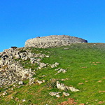
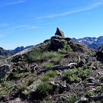
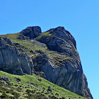
Urkulu (1423 m) Date: 28/11/2024 Zmin: 1190 m - Zmax: 1423 m - Dénivelé: 600 m Distance: 10,1 km - Temps Total: 05h30 (Marche: 04h20 - Pause: 01h10) |
|
|
|
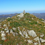
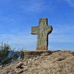
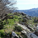
Sarimendi (1484 m) Date: 14/11/2024 Zmin: 1111 m - Zmax: 1484 m - Dénivelé: 640 m Distance: 10,8 km - Temps Total: 05h00 (Marche: 03h55 - Pause: 01h05) |
|
|
|
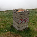
Pic de Pista (1779 m) Date: 06/11/2024 Zmin: 1472 m - Zmax: 1779 m - Dénivelé: 360 m Distance: 4,5 km - Temps Total: 04h40 (Marche: 02h30 - Pause: 02h10) |
|
|
|
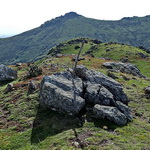
La Rhune (905 m) Date: 24/10/2024 Zmin: 220 m - Zmax: 905 m - Dénivelé: 710 m Distance: 8,4 km - Temps Total: 05h10 (Marche: 04h15 - Pause: 00h55) |
|
|
|
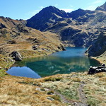
Lac de Bassias (2070 m) Date: 11/10/2024 Zmin: 1649 m - Zmax: 2141 m - Dénivelé: 560 m Distance: 11,1 km - Temps Total: 06h35 (Marche: 04h45 - Pause: 01h50) |
|
|
|
Pas du Gat (2465 m) Date: 24/09/2024 Zmin: 1845 m - Zmax: 2470 m - Dénivelé: 660 m Distance: 12,7 km - Temps Total: 07h50 (Marche: 06h00 - Pause: 01h50) |
|
|
|
Pic de Hountas (1751 m) Date: 14/09/2024 Zmin: 1263 m - Zmax: 1853 m - Dénivelé: 600 m Distance: 6,7 km - Temps Total: 05h00 (Marche: 03h50 - Pause: 01h10) |
|
|
|
Pic Les Tours (2129 m) Date: 13/06/2024 Zmin: 1413 m - Zmax: 2129 m - Dénivelé: 780 m Distance: 11,8 km - Temps Total: 09h10 (Marche: 06h05 - Pause: 03h05) |
|
|
|
Pic du Mondarrain (749 m) Date: 05/06/2024 Zmin: 59 m - Zmax: 749 m - Dénivelé: 840 m Distance: 12,8 km - Temps Total: 07h15 (Marche: 05h20 - Pause: 01h55) |
|
|
|
Cap d'Estanhs (2081 m) Date: 01/06/2024 Zmin: 1220 m - Zmax: 2081 m - Dénivelé: 870 m Distance: 11,8 km - Temps Total: 05h35 (Marche: 04h55 - Pause: 00h40) |
|
|
|
Soporro (616 m) Date: 25/05/2024 Zmin: 114 m - Zmax: 616 m - Dénivelé: 710 m Distance: 11,5 km - Temps Total: 05h45 (Marche: 04h15 - Pause: 01h30) |
|
|
|
Atxuria (759 m) Date: 19/04/2024 Zmin: 139 m - Zmax: 759 m - Dénivelé: 960 m Distance: 12,3 km - Temps Total: 07h50 (Marche: 06h20 - Pause: 01h30) |
|
|
|
Casque du Lhéris (1595 m) Date: 12/04/2024 Zmin: 661 m - Zmax: 1595 m - Dénivelé: 940 m Distance: 12,4 km - Temps Total: 06h35 (Marche: 05h30 - Pause: 01h05) |
|
|
|
Col de Ripeyre (1667 m) Date: 04/04/2024 Zmin: 1000 m - Zmax: 1679 m - Dénivelé: 700 m Distance: 7,2 km - Temps Total: 05h35 (Marche: 04h20 - Pause: 01h15) |
|
|
|
Pic d'Alian (1089 m) Date: 16/03/2024 Zmin: 500 m - Zmax: 1089 m - Dénivelé: 720 m Distance: 9,9 km - Temps Total: 06h00 (Marche: 04h30 - Pause: 01h30) |
|
|
|
Soum de las Picarras (1349 m) Date: 03/02/2024 Zmin: 455 m - Zmax: 1349 m - Dénivelé: 930 m Distance: 9,1 km - Temps Total: 06h55 (Marche: 04h45 - Pause: 02h10) |
|